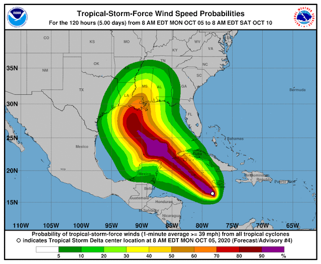
Tropical Storm Delta was approximately 135 miles south of Negril, Jamaica, as of 10 a.m., and approximately 265 miles southeast of Grand Cayman. The long-term track, which often changes, has the storm making landfall Friday near Terrebonne and Lafourche parishes and then turning east toward New Orleans and then heading into Mississippi.
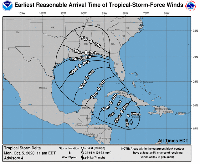
At 7 mph, the storm is going west. Speed is expected to pick up on Tuesday and Wednesday. The core of the storm is predicted to move away from Jamaica later in the day on the forecast route, move close to or over the Cayman Islands on Monday night, and reach the Isle of Youth and western Cuba on Tuesday afternoon or evening.
In the Caribbean Monday morning, Tropical Storm Delta was strengthening and is predicted to become a hurricane Tuesday on its way towards Louisiana, forecasters said.
In southeast Louisiana, the latest track from the National Hurricane Center has Delta making landfall Friday as a Category 2 hurricane, but this far away, the route has an average error of 160 to 200 miles.
Depending on the direction and strength of the system, heavy rain, hazardous storm surge, and gusty winds are all possible along the coast from Louisiana to the western Florida panhandle, forecasters said. For residents, now is the time to make arrangements and prepare.
Tropical Storm Gamma, weakening in the Gulf of Mexico, is also being watched by forecasters. It is near the peninsula of Yucatan and is not supposed to enter the U.S. Gulf Coast.
Forecasters said the long-term track becomes complex because they are unsure how Tropical Storm Delta will interact with the remnants of Tropical Storm Gamma.
The interaction "could result in a sharp westward jog, after which a sharp turn back toward the northwest could occur," according to Stacy R. Stewart, a senior hurricane specialist with the National Hurricane Center.
The latest track from the National Hurricane Center has the system moving into the southeastern Gulf of Mexico Tuesday night or early Wednesday.


